Regional Context: From the Southern Andes to Broader Ecuador
The Ingapirca archaeological site anchors the southern highlands of Ecuador, serving as the primary center for examining the region’s pre-colonial past. Visitors exploring the ancient origins of the Cañari and Inca civilizations often find themselves positioned perfectly to experience the broader cultural and natural geography of the Cañar and Azuay provinces. The immediate surroundings present a stark, high-altitude landscape punctuated by indigenous agricultural terraces and deep river valleys. This region acts as a focal point for travelers seeking a deep dive into Andean history before moving outward to the coastal plains or northern provinces.
Exploring these immediate southern attractions naturally inspires longer stays in the country. The archaeological precision found in the stone walls of Ingapirca provides a historical baseline that enriches the rest of the journey. From the southern highlands, the transportation networks facilitate direct routes toward the top-rated coastal estuaries, marine parks, and northern highland wonders. The Ecuador Ministry of Tourism actively promotes this southern circuit as the definitive starting point for comprehensive national itineraries. By utilizing Cuenca as a logistical hub, travelers can seamlessly connect the ancient stonework of Cañar with the ecological diversity spanning the equator.
Top Nearby Spots Comparison
| Destination | Distance from Cuenca | Primary Feature | Elevation |
|---|---|---|---|
| Ingapirca Ruins | 80 kilometers (2 hours) | Inca-Cañari Architecture | 3,160 meters |
| Cajas National Park | 30 kilometers (45 mins) | Glacial Lakes & Paramo | 3,100 – 4,450 meters |
| Gualaceo | 35 kilometers (45 mins) | Artisanal Markets | 2,370 meters |
| Puerto López | 450 kilometers (8 hours) | Whale Watching | Sea Level |
Highlights Around the Region
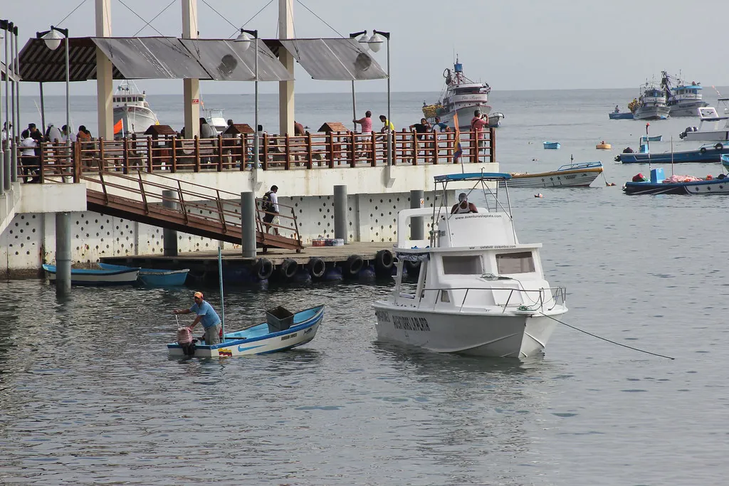
The Historic City of Cuenca
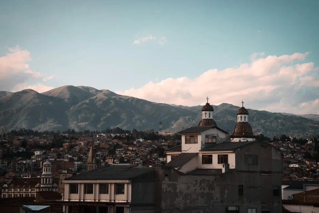
Cuenca stands as the undisputed logistical and cultural hub of the Azuay province, located just two hours south of the Ingapirca ruins. Recognized as a UNESCO World Heritage site, the city center is defined by its precise grid layout, monumental Spanish colonial architecture, and the four rivers that intersect its urban core. The Tomebamba River, flanked by centuries-old weeping willows and historic colonial homes, provides a natural boundary between the historic district and the modern city. Most travelers establish their base here, utilizing the city’s extensive infrastructure to book an organized excursion combining Ingapirca with the artisanal towns of Gualaceo and Chordeleg.
Beyond its utility as a transit hub, Cuenca requires dedicated time to comprehend its layered history. The Pumapungo Archaeological Park, located directly within the city limits, offers a direct continuation of the narrative started at Ingapirca. Here, the Inca emperor Tupac Yupanqui constructed an extensive administrative center over the conquered Cañari settlement of Guapondelig. Visitors can inspect the remaining foundation stones, walk through the terraced gardens, and view the extensive collection of ethnographic artifacts housed in the adjacent museum. Travelers focused on the ancient architecture often book a small-group exploration of the ruins and the surrounding Inca mountain face to fully grasp the engineering capabilities of these pre-colonial civilizations. The contrast between the imposing Catholic cathedrals in the central plaza and the indigenous stonework at Pumapungo illustrates the complex historical reality of the southern Andes.
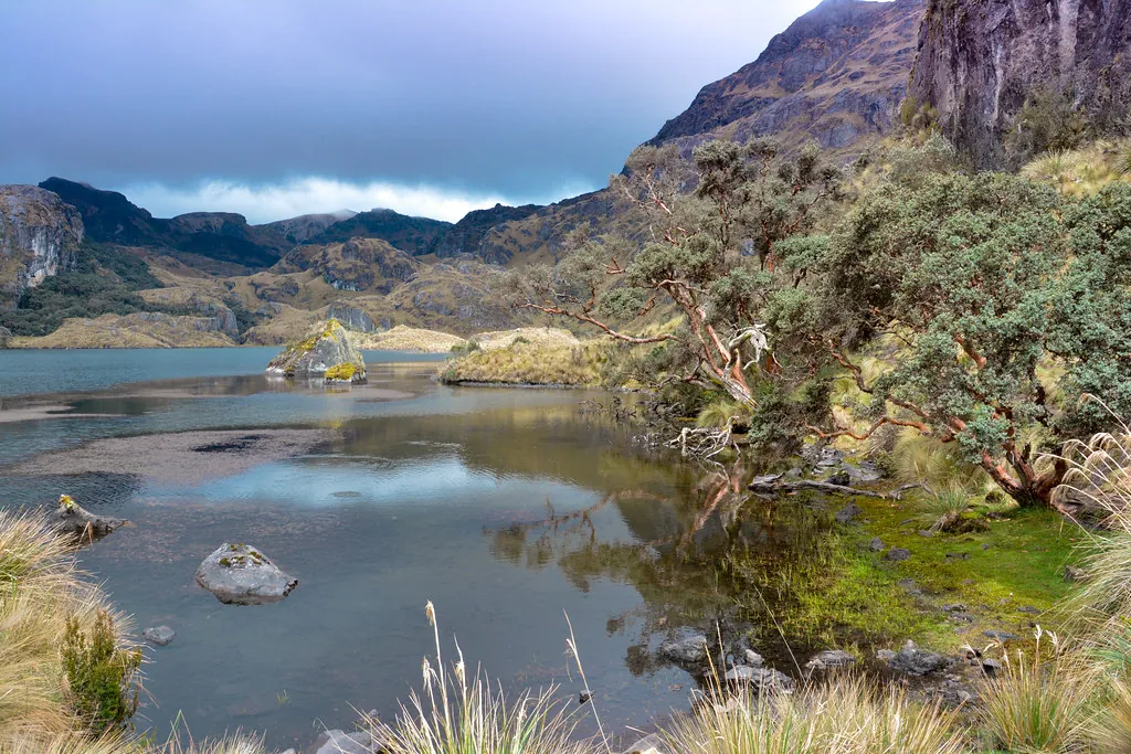
Cajas National Park
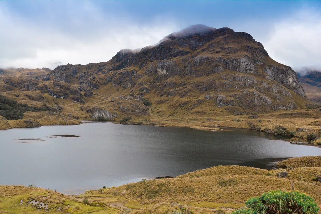
Immediately west of Cuenca, the terrain rises sharply into the dramatic, glacially carved landscape of Cajas National Park. Spanning over 28,000 hectares, this protected area features a jagged topography of tundra-like paramo ecosystem, punctuated by more than 250 high-altitude lakes. The park operates under the jurisdiction of the official Cajas National Park administration, which maintains strict visitor limits and clearly demarcated hiking trails to protect the fragile watershed. This region acts as the primary water source for Cuenca and heavily influences the localized weather patterns of the southern highlands.
Hiking in Cajas requires serious physical preparation due to the extreme elevation, which ranges from 3,100 to 4,450 meters above sea level. Travelers transitioning from the moderate climate of Cuenca to these rugged peaks must prioritize acclimatization. Reviewing strategies for high-altitude environments is mandatory before attempting routes like the Laguna Toreadora circuit. The trails offer sightings of native flora, such as the paper-barked Polylepis trees, and fauna including free-roaming alpacas and the Andean condor. The stark, silent environment of the park provides a sharp contrast to the dense urban architecture of the colonial cities below.
Gualaceo and the Artisanal Valleys
A short drive east of Cuenca brings visitors into the subtropical valleys of the Azuay province, where towns like Gualaceo and Chordeleg preserve centuries-old artisanal traditions. Gualaceo is particularly noted for its complex ikat weaving techniques, a pre-Columbian method of tie-dyeing warp yarns before weaving them into intricate shawls known as macanas. Local workshops operate exactly as they have for generations, utilizing backstrap looms and natural dyes extracted from walnuts, cochineal insects, and local flora. Observing these artisans at work provides crucial context for the textiles frequently uncovered in regional archaeological excavations.
The valley also serves as a critical agricultural zone, producing a wide array of fruits and vegetables that supply the highland markets. The central market in Gualaceo is an essential stop for culinary exploration, featuring traditional dishes that define the region’s gastronomy. Travelers can sample hornado (slow-roasted pork) and pristine local produce, making it an excellent practical companion to any comprehensive study of local highland cuisine. The warmer climate of this valley offers a physical reprieve from the chilling winds of the paramo, allowing visitors to experience the full spectrum of Andean microclimates within a single day.
Top-Rated Selections (Ecuador’s Diverse Landscapes)
1. Isla Corazón (Natural)
Located in the estuary of the Chone River near Bahía de Caráquez, Isla Corazón is a naturally heart-shaped mangrove island spanning over 500 hectares. The island is managed by the Ministry of Environment and Energy in collaboration with a local community of artisanal fishermen who have banded together to conserve the delicate mangrove ecosystem. Visitors board traditional wooden canoes for silent, eco-friendly tours through the dense mangrove tunnels, learning about the complex root systems and the balance of the estuary. The community’s initiative has successfully restored large tracts of deforested mangroves, transforming the island into a sanctuary for both wildlife and sustainable travel.
The undisputed highlight of Isla Corazón is its thriving avian population, most notably the colossal nesting colony of magnificent frigatebirds. Between December and April, the island becomes a chaotic, active nursery as male frigatebirds inflate their bright red throat pouches to attract mates. Beyond the frigatebirds, the mangroves shelter over 60 species of birds, including white ibises, pelicans, and various herons. Walking along the elevated wooden boardwalks constructed by the locals, visitors can immerse themselves in the symphony of bird calls and the rustling of crabs on the muddy floor, making it an essential detour for nature enthusiasts.
2. Puerto López (Natural)
Puerto López, a bustling fishing town on the central coast of Ecuador’s Manabí province, serves as the unrivaled capital for whale watching in the country. Every year, between the months of June and September, thousands of Antarctic humpback whales migrate over 8,000 kilometers to the warm, shallow equatorial waters off the Machalilla National Park to mate and give birth. The town transforms into a bustling marine tourism center, with dozens of certified tour operators launching daily boat expeditions. These guided trips offer visitors a front-row seat to the whales’ spectacular acrobatic displays, including full-body breaching, tail slapping, and spyhopping.
Beyond the sheer thrill of witnessing 40-ton marine mammals launch themselves into the air, the whale watching industry in Puerto López is tightly regulated to ensure the protection of the animals. Monitored closely by the Ministry of Environment and Energy, boats must adhere to strict distance and time limits. Many tours are accompanied by marine biologists or trained naturalist guides who provide deep insights into humpback behavior. When the boats return to shore, the town itself offers a lively atmosphere with beachfront cabañas serving fresh seafood like ceviche and encocado de pescado. Puerto López acts as a direct gateway to understanding Ecuador’s rich marine biodiversity.
3. Tulcán Cemetery (Cultural/Historical)
The José María Azael Franco Cemetery in Tulcán, located in Ecuador’s northernmost province of Carchi on the Colombian border, is unlike any other burial ground in the world. Originally established in 1932 to replace a cemetery damaged in a 1923 earthquake, it has evolved into a sprawling, mesmerizing topiary garden. Local groundskeeper José María Azael Franco began sculpting the native cypress bushes in 1936, transforming the green spaces into an elaborate labyrinth of arches, geometric shapes, and intricate figures inspired by pre-Columbian, Roman, and Egyptian art. Today, the cemetery spans 8 hectares (about 20 acres) and features more than 300 sculpted figures.
Recognized as a national cultural heritage site in 1984 by the National Institute of Cultural Heritage (INPC), the Tulcán Cemetery invites visitors to wander through its serene, green corridors, creating a unique juxtaposition between life, art, and the memorialization of the dead. The high-altitude climate of Tulcán, sitting at nearly 3,000 meters above sea level, provides the perfect conditions for the cypress trees to thrive and hold their dense, sculpted shapes. Exploring this site presents a quiet, reflective experience that highlights the deeply ingrained artistic traditions of the Andean highlands, providing a stark contrast to the ancient stone ruins found further south.
Getting Around
Navigating the southern Andes requires an understanding of the regional transportation networks, which are primarily anchored by the Terminal Terrestre in Cuenca. This massive bus terminal dispatches hundreds of routes daily, connecting the Azuay province to the Cañar highlands and the coastal lowlands. For those focusing strictly on the archaeological sites, direct transport is available, but many choose to hire a private transfer and guided tour to Ingapirca for greater schedule flexibility. Public buses traversing the winding, high-altitude roads require a strong stomach and a high tolerance for sudden elevation changes.
- Cuenca to Ingapirca: Direct buses depart from the Terminal Terrestre, taking approximately two hours. Departures are frequent in the early morning, allowing visitors to arrive before the midday crowds.
- Cuenca to Cajas National Park: Westbound buses heading toward Guayaquil cross directly through the park’s main access road. Requesting a drop-off at the Laguna Toreadora visitor center is the standard protocol.
- Cuenca to Gualaceo: Regular local transit routes depart every 30 minutes from the city center, taking under an hour to reach the artisanal valleys.
Returning from day trips like Cajas requires situational awareness. You must flag down an eastbound bus returning from the coast along the main highway. This process demands patience and should always be attempted during daylight hours to ensure maximum visibility for approaching drivers.
For those pushing out toward the coastal marine reserves like Puerto López, overnight buses remain the most efficient option. These long-haul routes bypass the intense daytime heat of the lowlands and save on accommodation costs, running consistently from the main terminal.
Understanding the logistical flow of the southern provinces allows travelers to maximize their time between the high-altitude archaeological sites and the equatorial coast.