Introduction: The Architectural Synthesis of Ingapirca
“Ingapirca” by jrubinic is licensed under BY. Source: OpenverseThe Complejo Arqueológico Ingapirca occupies a windswept plateau at 3,160 meters in Ecuador’s Cañar Province. The ruins represent a rare cultural bridge between two formidable pre-Columbian societies. Visitors often expect a site of violent conquest. The stonework reveals a sophisticated diplomatic merger. The architectural layers they left their mark on illustrate a timeline of assimilation rather than destruction. You can observe this duality directly on a small-group archaeological tour from Cuenca, examining the exact points where Cañari river stones meet Inca andesite blocks.
The Cañari Foundation and Inca Arrival
Long before the Inca expansion of the 1460s, the indigenous Cañari people established Hatun Cañar as a lunar observatory and ceremonial center. Their construction methods relied on organic, curvilinear geometry designed to harmonize with the surrounding topography. According to local mythology, the Cañari trace their lineage to the Legend of the Guacamayas—two mythical macaws that rescued the civilization’s ancestors from a great flood. When Túpac Yupanqui’s imperial forces arrived, initial skirmishes eventually gave way to strategic intermarriage and political alliances.The resulting Ancient Origins & Architecture of the site demonstrate this peace pact in physical form. The Inca built their structures directly adjacent to, and sometimes atop, the existing Cañari foundations. The stratigraphy of the terrain proves that Cañari lunar practices continued undisturbed alongside the newly introduced Inca solar worship.
Masonry Comparison: River Stone vs. Ashlar
Cañari MasonryThe indigenous builders sourced rounded river stones from the valleys below, securing them with a thick, mud-based mortar. These foundations reflect an earthly, organic aesthetic prioritizing water rituals and lunar cycles. The Cañari calendar stones feature twenty-eight carved cavities that held water to reflect the night sky, allowing agricultural planners to track the phases of the moon with absolute precision.
Inca Ashlar MasonryThe imperial engineers introduced dry-stone ashlar masonry. They cut green andesite blocks with astonishing precision, interlocking them without mortar to withstand seismic activity. Preserving these exact joints remains a modern challenge; an official Ecuadorian cultural heritage report noted that 1990s chemical cleaning methods inadvertently accelerated the biodeterioration of the volcanic rock.
Architectural Features Comparison
Feature
Cañari Style
Inca Style
Primary Material
River Stone bound with Mortar
Green Andesite (Dry-stone)
Geometry
Organic and Curvilinear
Trapezoidal and Rectilinear
Ritual Focus
Lunar Tracking and Water Ceremonies
Solar Alignment and Imperial Administration
The Temple of the Sun and Sacred Geometry
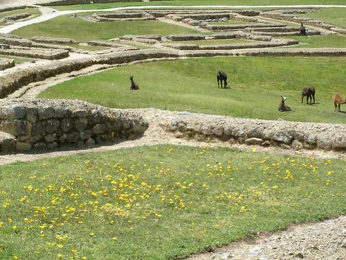
The undisputed focal point of the complex is El Castillo, the only known elliptical Inca temple in South America. Measuring thirty-seven meters long and twelve meters wide, the structure crowns a natural rock outcrop. The precision of teh stonework reaches its apex here, with trapezoidal doorways designed to absorb structural stress during earthquakes. The main altar aligns perfectly with the solstices, operating as an immense agricultural clock for the surrounding valleys.Arriving late in the afternoon—specifically after 14:00—provides the sharpest golden hour lighting to photograph the mortarless joints, as the angular sunlight casts deep shadows across the green andesite. The site takes on a completely different atmosphere during the Inti Raymi solstice celebrations. On June 22, 2026, the temple grounds will host thousands of indigenous participants conducting traditional Quechua ceremonies, a spectacular departure from the usual quiet observation of the ruins. You can confirm the annual schedule through the official administrative registry.
“Ingapirca stands as a rare physical record of the peaceful integration of two distinct Andean civilizations, where the lunar traditions of the Cañari were elevated by the solar precision of the Inca.”
Administrative Life and Site Stratigraphy
Beyond the ceremonial spaces, the Kallanka halls served as massive rectangular administrative centers for the expanding empire. These structures housed imperial troops, messengers (chasquis), and bureaucratic officials managing the northern territories. The overlapping site stratigraphy provides undeniable proof of coexistence. A walk through The Temple of the Sun & Landmarks exposes the distinct transition lines between the rounded Cañari retaining walls and the rectilinear Inca barracks. The design served as a psychological tool, projecting imperial power while respecting local religious customs.
Navigating the Site: Logistics and Insider Strategy
Accessing the core ruins requires joining a mandatory 40-minute guided tour to prevent structural degradation. The official $2.00 USD entry fee theoretically includes an English-speaking guide. Recent travel reports indicate a severe shortage of bilingual staff. Independent travelers are frequently placed in Spanish-only groups. Booking a private bilingual guide in advance through Cuenca Bestours (Alfonso Moreno Mora 1-75, $50.00 – $130.00 USD) circumvents this language barrier. Budget-conscious visitors can execute a highly efficient $10.00 DIY transit hack. The Transportes Cañar direct bus departs Cuenca’s Terminal Terrestre for $8.00 USD round trip.The bus reliably arrives around 11:30 AM. Expect a 45-minute wait before your staggered entry time; use this window to explore the onsite Museo Arqueológico or the remarkably clean free restrooms inside the administrative building. Flashing a valid university ID drops the entry fee to $1.00 USD, while minors under twelve enter free. Read our Planning Your Visit guide to optimize your itinerary.
The Hidden Loop and the Almuerzo Economy
Following the mandatory tour, the guards release visitors to explore the exterior paths. Keep slightly left as you exit the main complex toward the modern houses to locate the Intihuayco trail. This steep, 30-minute self-guided loop passes ‘La Tortuga’—a naturally formed tortoise rock—and culminates at the Cara del Inca mountain face. You must pace yourself during the rigorous climb back up; the 3,200-meter elevation routinely catches tourists off guard. Review our altitude sickness prevention tips before attempting the ascent.Pack light and skip the expensive imported snacks. The rural ‘almuerzo’ economy provides massive multi-course lunches for $2.50 to $4.00 USD in nearby El Tambo. Upon returning to Cuenca, grab a legendary $2.60 pernil sandwich at Los Sandwiches de Doña Piedad or a loaded $1.50 hotdog at Las Piezas del Maño to experience authentic traditional Andean cuisine. If you have time while waiting in El Tambo, walk the abandoned railroad tracks from the Coyoctor archaeological site directly to the Plaza del Arte for a free cultural detour.
Security and Digital Connectivity in the Cañar Province
The Andean highlands maintain incredibly low crime rates enforced by ‘castigo indígena’ (community justice). You should still exercise situational awareness against petty scams. Unsolicited locals may approach the entrance gates to deliver historical lectures; politely say “No, gracias” and keep walking to avoid aggressive demands for tips. Watch out for the coordinated mustard distraction scam on public buses—always keep your daypack in your lap. For more comprehensive regional details, consult our Ecuador safety guide.Do not rely on rural cellular networks for remote work. The Cañar province lacks the bandwidth required for video calls. Digital nomads should process their photos and emails back in Cuenca using a robust Claro SIM or an Airalo eSIM, taking advantage of high-speed hubs like Slow Brew or the Socialtel Cuenca coworking space. The heavy afternoon convective rainstorms frequently render the ancient stone steps dangerously slippery, making sturdy footwear non-negotiable for anyone exploring the outer terraces.
In the year 2000, following a severe economic crisis and the rapid devaluation of the native sucre, the Ecuadorian government made the unprecedented decision to adopt the United States Dollar as its official legal tender. This macroeconomic shift immediately stabilized the nation’s financial system and fundamentally altered the daily commerce of the Andean region. Today,…
The “Four Seasons in One Day” Highland Climate Preparing for an expedition to the Ingapirca archaeological complex requires acknowledging the volatile environmental realities of the Cañar province. Situated at an elevation of 3,160 meters (10,367 feet), the site sits on an exposed Andean plateau where atmospheric conditions change with notorious speed. Visitors must abandon the…
The Agricultural Foundation of the Andes Dining in the Cañar and Azuay regions provides a direct link to the agricultural foundation of Ecuador. At the 3,160-meter altitude of the Ingapirca Ruins, the culinary atmosphere relies on warmth, caloric sustenance, and a deep reliance on the earth’s seasonal cycles. The harsh Andean climate historically demanded hearty,…
Introduction to Altitude Changes in Ecuador Traveling through Ecuador demands a rapid physical adjustment that few other destinations require. Visitors frequently land at sea-level airports in the coastal plains, specifically Guayaquil, and drive directly into the Andean highlands within a matter of hours. This sharp, vertical ascent forces the human body to adapt to significantly…
Introduction: Walking the Path of the Sun The spine of the Andes hides a sprawling network of ancient arteries. Long before modern highways cut through the Ecuadorian highlands, the Qhapaq Ñan served as the absolute logistical core of the Inca Empire. Walking the three-day route from the remote farming village of Achupallas to the Ingapirca…
I. REGIONAL CONTEXT: Anchoring Southern Ecuador Cuenca functions as the primary cultural and logistical hub for exploring the southern Andean topography of Ecuador. The city center, designated a UNESCO World Heritage site due to its 16th-century Spanish grid and preserved architecture, offers a highly developed infrastructure for regional excursions. The true strategic value of the…